We finally got away from Aqua Yacht Marina at the start of the Tenn-Tom waterway on Tuesday the 27th. The rain had let up to a light mist but the wind was pushing us hard onto the dock. Had to get a bit creative but we got away OK. We were traveling with 2 other boats and had a fairly short 40 mile day planned to Bay Springs Marina just before you start a series of very close locks. A few miles after leaving the marina we entered the canal section of the waterway that goes about 25 miles before opening into Bay Springs Lake. Interesting factoid about the canal is that more dirt was moved in this stretch than the entire Panama Canal.
 |
| View on the chart-plotter. |
 |
| Our view for the next 25 miles. |
The nice thing about traveling in the "ditch" was that we were protected from the wind for the most part even though the misty rain continued. The heavy rain from the previous 2 days didn't change the water level much or add debris to the canal thanks to revetments built in to control the flow of creeks.
Bay Springs Marina was not much more than a convenient place to stop for the night. No restaurant or amenities and a bit pricey for what you get. We were underway early the next morning to start heading through the locks. Whitten Lock was just below the marina and the largest drop of the entire waterway at 84 feet. After this the locks would drop 25-30 feet and only take about 20 minutes each to get through. The lock-masters pass along who is passing through and the next lock is ready when you get there.
 |
| Our 2 buddy boats in Whitten Lock. |
At one point we passed an up bound tow. They are much smaller here than the Ohio or Tennessee rivers but the waterway is much more narrow too. AIS made it easier for us to set up a pass well in advance but it's still tight.
After the first three locks our new friends on Jammin Jane and Knot Sew Easy pulled into Midway Marina but Jill and I decided to press on and finish the next three locks. We pulled into an old section of the river channel and spent a nice quite night at anchor. We look forward to meeting up with them again when we hit the gulf.
The next couple of days we were pretty much by ourselves as we traveled along. We stopped at Pirates Cove Marina the next night and had a bit of time to tour the Tom Bevill visitors center and the old snag boat Montgomery. Very interesting and a nice chance to stretch our legs after 2 days on the boat.
 |
| Visitors Center at Bevill Lock. |
 |
| Snag Boat Montgomery. |
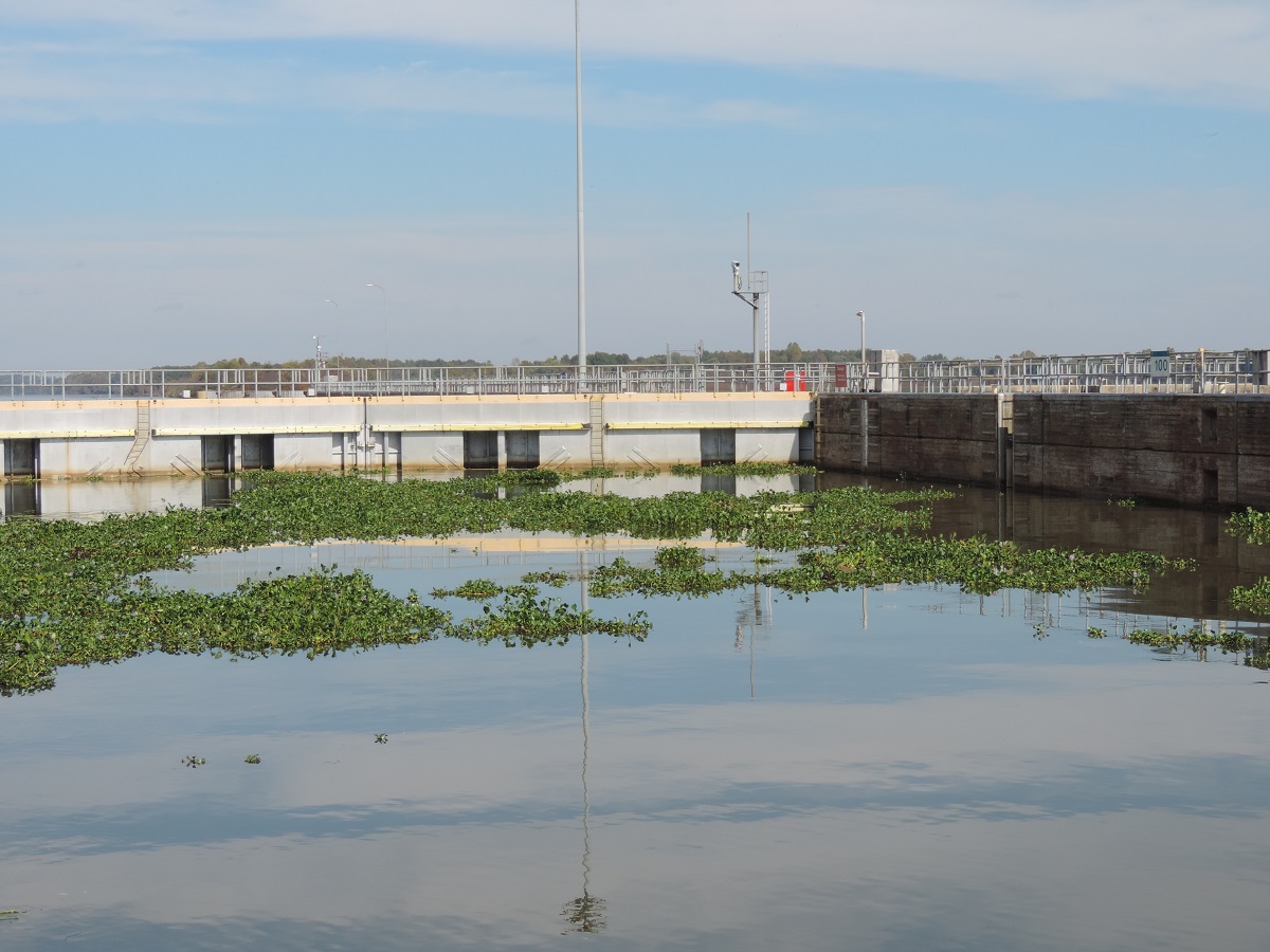
We had one very interesting lock as we were heading down. As we approached the lock it looked like we had to go through land to get there! As we got closer it turned out the whole area was covered with floating lilies....a bit unnerving to say the least.
 |
| Zoom In... |
 |
| After the doors closed behind us. |
With all the locks we've covered so far Jill is getting very good and comfortable in getting the boat secured. Only 2 more to to before the gulf!!
 |
| Happy Crew!! |
The next day we had planned to anchor again just below our last lock however there was a dredging operation going on blocking where we wanted to go. Oh well, we looked at the charts and the time and did some siferin' and figured we had time to make the marina at Demopolis, AL before dark. The plan worked out and we were tied up by 6:00. That was a long 90 mile day but still enjoyable.
Along the way we passed 2 cool features. First is the I-20/59 bridge. As many times as we have driven over that bridge on the way to NOLA I have always smiled and said...one day....
 |
| Today's the day! |
The other neat thing was passing the "white cliffs of Epes". I understand these are the same formations as those in Dover, England only smaller....who knows, ask Google. We were passed by a go fast boat just as we got there, ended up at the same marina with more fuel in my tanks.
 |
| The white cliffs of Epes. |
We also began to see Spanish Moss in the trees about this time. We're getting south now!!
Two big things about getting here; we have officially passed the half way point on the Tenn-Tom, and this is the last marina we will see till Mobile Bay! Actually just above this marina the Tennessee Tombigbee waterway ended where the Black Warrior river joins the waterway. From here to the top of Mobile Bay we will be on the Black Warrior-Tombigbee waterway.
Had some good storms last night and rain all day today so we may get a bit of push as we head down river. Hopefully there won't be too much drift in the water. This will be the last post till Mobile for sure. No marinas or reliable cell service between here and there. Basically we will travel till an hour or two before sunset (5 o'clock now) and find a spot out of the channel to anchor. We have looked at the charts and figure it will take about 4 days to Fairhope on the Eastern shore of Mobile Bay. Wish us luck!!


wahhhh - you guys are livin the dream! Others should be so lucky. I hope, some day soon, to be livin the dream ...
ReplyDelete