Today is the day we have been looking forward to/fearing for the past few weeks. We will be leaving Port St. Joe marina about 11:00 (we are now back on EST) and heading out into the big scary Gulf of Mexico. We ran in the gulf from Panama City to here just to see what it was like and seas at 2-4 feet were a wee bit uncomfortable but not too bad on the nose. Forecast over the next 48 hours is for seas less than 2 feet along the entire route, should be a smooth run (knock on wood). We will be covering a bit over 200 miles and should be in to Dunedin around noon Tuesday. The tracker will be on so if any of you wake up Tuesday morning and see us going in circles please call the Coast Guard....
Really, this should be no big deal, just a very long day. There were 2 sailboats that left this morning from here and several boats headed from Carrabelle so we will have company along the way. Our sister ship is docked behind us and we will be traveling together.
Wish us luck and follow along. Look for a post late week on the uneventful crossing and some pictures from Port St. Joe, a very nice town.
Monday, November 30, 2015
Friday, November 27, 2015
Pensacola to Panama City
Well, once again we pulled into a marina for 2 nights and ended up staying 4. We pretty much knew this would happen based on the forecast and Pensacola is not a bad place to be stuck. We've had a few questions about what makes it a go or no-go day. If we have to cross large bodies of water like Pensacola bay we hope to avoid strong winds, rain without storms is not much of a problem. Pictures below show a typical no-go day...
When we left Pensacola Thursday morning (the 19th) the bay had calmed down to a light chop. Very do-able conditions. Once down the bay we turned east into Santa Rosa sound and had a pretty stiff breeze on our bow most of the day. Nothing uncomfortable, just some spray over the rail now and then. Pretty cool looking until you remember you have to clean all the salt off at the end of the day.
As we traveled east toward Ft. Walton we were treated to a private airshow along the way. OK maybe not private or an airshow but this area has several military bases and you can see just about anything in the inventory flying at some point. We saw several pairs of the new F-22 Raptor (too quick for pictures) as well as the V-22 Osprey and C-130 as we tooled along.
End of the day found us in an anchorage just NE of Destin FL called Joe's Bayou. There were nice homes all around the waterfront but no one came out and yelled at us for anchoring in their backyard. I hear this can be a problem in other parts of Florida.
Next morning we continued east on Choctawhatchee Bay heading toward Panama City. We had a slight "issue" that morning as we were getting underway. For some reason I had turned off the autopilot the night before, I don't normally do this. Well, as we were heading out the narrow channel toward the bay I engaged the pilot and the boat started turning hard to the right...toward the shallows. I quickly dis-engaged the pilot but the boat was starting to shudder as it rubbed the sandy bottom. Putting the engines in neutral the boat floated through the shallow area and we were soon back in deeper water and on our way. Looking at the chartplotter the boat icon was moving along "backward"??? Light bulb finally went off at this point and a quick check of the real compass showed the autopilot was reading almost 180 degrees in the wrong direction. We were able to re-calibrate the electronic compass later in the afternoon when we hit calmer waters and all is back to normal, lesson learned!
At the eastern end of Choctawatchee Bay is an area they call the grand canyon. It's not really a canyon but a canal cut to connect to West Bay near Panama City. It's 25 miles of nothing but a welcome calm after the choppy bay.
Once into West Bay we calibrated the compass and head to the North side of the bay and a quite anchorage for the night. The next morning was a short run to St. Andrews Bay and Panama City Marina. This time we booked a weeks stay since the Gulf wasn't looking to calm down anytime soon and marinas farther east were filling up with boats waiting to cross. We rented a car for a couple of days and re-stocked the boat and Jill finally got a haircut! We also got the dinghy down and explored the area a bit. One day we headed over to Shell Island where....we had issue 2. Almost to the island the motor quit. I was able to re-start it but it wouldn't keep running. Since we were drifting toward the shallows I thought it was a good time to try out our Tow Boat US membership (kinda like AAA for boats). A quick phone call and the nice fella said he would be there in 20 minutes. Since we were in shallow water I had to row against the wind and current to get us out to deeper water. Once there I began looking over the motor and found that the propane fuel line had unscrewed a bit from the engine. Tightened it up and we were back in business!! Another call to cancel the tow and we decided to head back and find a bar....Lesson #2, again, no harm no foul.
Jill and I made a nice Thanksgiving feast on the boat yesterday and enjoyed docktails with fellow loopers for sunset. A very nice holiday but we do miss spending time with family & friends.


The marina is all decorated for Christmas and next weekend is the lighted boat parade but it's time to get moving. Tomorrow we will head off shore for the short run to Port St. Joe. The plan is to spend a couple of nights there and be in a better position for the crossing. Right now Monday or Tuesday is looking very promising for calm waters on the Gulf. Stay tuned to the tracker and hopefully you'll see us heading toward Dunedin early next week. It will be an overnight run so you night-owls can have something to do all night!!

 |
| Pretty Uncomfortable. |
 |
| Pretty Dangerous. |
 |
| Pensacola Bay looking south. |
 |
| C-130 |
 |
| V-22 |
Next morning we continued east on Choctawhatchee Bay heading toward Panama City. We had a slight "issue" that morning as we were getting underway. For some reason I had turned off the autopilot the night before, I don't normally do this. Well, as we were heading out the narrow channel toward the bay I engaged the pilot and the boat started turning hard to the right...toward the shallows. I quickly dis-engaged the pilot but the boat was starting to shudder as it rubbed the sandy bottom. Putting the engines in neutral the boat floated through the shallow area and we were soon back in deeper water and on our way. Looking at the chartplotter the boat icon was moving along "backward"??? Light bulb finally went off at this point and a quick check of the real compass showed the autopilot was reading almost 180 degrees in the wrong direction. We were able to re-calibrate the electronic compass later in the afternoon when we hit calmer waters and all is back to normal, lesson learned!
At the eastern end of Choctawatchee Bay is an area they call the grand canyon. It's not really a canyon but a canal cut to connect to West Bay near Panama City. It's 25 miles of nothing but a welcome calm after the choppy bay.
 |
| Entrance from the bay. |
 |
| The Grand Canyon. |
 |
| Billboard??? |
Jill and I made a nice Thanksgiving feast on the boat yesterday and enjoyed docktails with fellow loopers for sunset. A very nice holiday but we do miss spending time with family & friends.


The marina is all decorated for Christmas and next weekend is the lighted boat parade but it's time to get moving. Tomorrow we will head off shore for the short run to Port St. Joe. The plan is to spend a couple of nights there and be in a better position for the crossing. Right now Monday or Tuesday is looking very promising for calm waters on the Gulf. Stay tuned to the tracker and hopefully you'll see us heading toward Dunedin early next week. It will be an overnight run so you night-owls can have something to do all night!!

Tuesday, November 17, 2015
Fairhope AL. to Pensacola FL.
We finally left Fairhope on Nov. 11th after some weather and mechanical delays. We had asked for a fairly simple job to be done while at the marina but they didn't get to it till Tuesday and broke a bolt in the process. By the time he finished it was too late in the afternoon to head out. The delay didn't hurt us since Wednesday was the pick of the week in getting down Mobile Bay.

Once down the bay we picked up the Gulf Intracoastal Waterway and headed east. After a short time we pulled into LuLu's which is a nice spot we had been to by car several times. It was pretty cool to stop for lunch there while on the boat. The restaurant is owned by Lucy Buffett but we didn't see her more famous brother while we were there. They have a nice marina there also but we went on a bit further to the Wharf in Orange Beach for the next 2 nights.
Once at the Wharf we found that there was a two week music festival going on all along the gulf coast from Pensacola to Gulf Shores. There was a venue at the Wharf and that night there was a song writer from Cincinnati on the schedule....go figure!!
We stayed at the Wharf 2 nights because the price was good for us Loopers but it really isn't our kind of place. It's a very nice new marina but the complex is a big shopping and condo place pretty much removed from Orange Beach proper.We next moved a short distance to Orange Beach Marina which is closer to the area we have always hung out in.
On the way to OBM we passed the Perdido Pass leading to the Gulf. It looked like a pretty calm day out there but we weren't heading that way yet.
Saturday we took the courtesy car over to Pirates Cove for more of the music festival. It is a pretty funky place which is packed during the warmer months. We had a nice lunch and listened to some more good music before heading back to Orange Beach. I'll give a little disclaimer here in that I don't usually take photos in the men's room but I thought this was an example of recycling at it's best.

Santa even payed a visit before heading north for the busy season.

Sunday we left Alabama and made it to Florida. We won't cross another state line until next spring. It was windy and a bit choppy but not too bad until we crossed the Pensacola Pass. There the surf was pushing in from the gulf and we rolled quite a bit for a short time till we got into the protection of the bay.
On our left entering the bay we passed Pensacola Naval Air Station. One of the same type ships we saw under construction in Mobile was docked there. These things just look fast!! There was a small patrol boat making sure we didn't get too close.

Once into the bay we could see downtown Pensacola. We were told to look for a big blue ship and head for it, the marina would be on the left. Turns out it was a pretty easy target.

We got in and tied up next to the restaurant by early afternoon and got out to walk around town a bit. This marina is right in downtown and a very nice place to explore from. Our first stop was the Pensacola Bay Brewery which happened to be having their 5th anniversary party that day...what's the chance of that?!?! They had free food and bands as well as great beer! I will say you don't see many Didgeridoo players in these parts.


It looks like we will be here for another day or two waiting out another storm front. I will say there are much worse places to be stuck! There are about a dozen looper boats here waiting for the bay to calm down so we can continue east. No rush to go as there is no gulf crossing window for at least a week. I'll leave you with a few more pictures of the marina. If the Blue Wahoo's were playing we could watch the game from the boat! Keep an eye on the Locate Us tab Thursday or Friday and you'll know if we're moving.


Once down the bay we picked up the Gulf Intracoastal Waterway and headed east. After a short time we pulled into LuLu's which is a nice spot we had been to by car several times. It was pretty cool to stop for lunch there while on the boat. The restaurant is owned by Lucy Buffett but we didn't see her more famous brother while we were there. They have a nice marina there also but we went on a bit further to the Wharf in Orange Beach for the next 2 nights.
 |
| LuLu's |
 |
| Dallas Moore (center) |
 |
| The Wharf |
 |
| Perdido Pass |
 |
| Orange Beach Marina |

Santa even payed a visit before heading north for the busy season.

Sunday we left Alabama and made it to Florida. We won't cross another state line until next spring. It was windy and a bit choppy but not too bad until we crossed the Pensacola Pass. There the surf was pushing in from the gulf and we rolled quite a bit for a short time till we got into the protection of the bay.
 |
| Our First Lighthouse. |
 |
| Fort Pickens |

Once into the bay we could see downtown Pensacola. We were told to look for a big blue ship and head for it, the marina would be on the left. Turns out it was a pretty easy target.

We got in and tied up next to the restaurant by early afternoon and got out to walk around town a bit. This marina is right in downtown and a very nice place to explore from. Our first stop was the Pensacola Bay Brewery which happened to be having their 5th anniversary party that day...what's the chance of that?!?! They had free food and bands as well as great beer! I will say you don't see many Didgeridoo players in these parts.


It looks like we will be here for another day or two waiting out another storm front. I will say there are much worse places to be stuck! There are about a dozen looper boats here waiting for the bay to calm down so we can continue east. No rush to go as there is no gulf crossing window for at least a week. I'll leave you with a few more pictures of the marina. If the Blue Wahoo's were playing we could watch the game from the boat! Keep an eye on the Locate Us tab Thursday or Friday and you'll know if we're moving.

 |
| Nov Goliath in the background. |
 |
| Lunch Spot. |
Sunday, November 8, 2015
We Made It!!!!
Sorry for the delay in posting an update but we made it to saltwater! We are now on the eastern shore of Mobile Bay in the lovely town of Fairhope, AL. We like to call this area LA or Lower Alabama and have been enjoying it since we got in on Thursday.
So, a little bit of trip recap. We left Demopolis on Monday morning with 2 other boats about 0830. There was a flotilla of 8-10 boats that left at first light which is about 0600 with the time change. We're not the early birds and prefer to travel with less boats. The second to last lock was just below the marina and we were in and out in about 30 minutes and on our way. The forecast was for mostly cloudy with improving conditions over the next few days. It seems then they say mostly cloudy around here it means all the way to the ground.

It was kind of a pain to be up and down between the helms all day but we had ground to cover so we motored on. The best case scenario was anchoring out three nights before getting to Mobile. First night we had made about 70 miles and anchored out of the channel near a sharp bend. We knew we'd be well out of the path of tow traffic as they had to swing wide to make the bend. I talked to the first tow to come by and he confirmed we were plenty safe. Still, I felt more comfortable "sleeping" on the futon at the lower helm just in case....not needed. Next day was about the same thing with misty rain and another 70 miles. Anchorage was a bit better as we were behind a couple of channel markers so I was doubly sure we were out of the way and could sleep in bed. Good thing because it's easier to sleep if you don't know what you're missing....

After a peaceful night on the hook we were delayed a few hours in the morning due to fog. Pic below is the same boat anchored behind us.
Finally got going about 0930 for the last leg to Mobile. Tonight we would anchor about 10 miles above Mobile bay for an easy 30 mile run to Fairhope the next morning. The sun finally came out and after we cleared the last lock on the Tenn-Tom (woo-woop!!) the scenery began to take on more of a cypress swamp look. Jill spotted the first gator today! We keep getting souther and souther!!

This night we anchored in Bayou Canot made famous by a tow making a wrong turn in 1994 and hitting a railroad bridge just before an Amtrak came by. 49 people were killed when the train crashed into the bayou. Thankfully the barges stayed in the river this night and we had a very peaceful rest.
Next morning we made our way back out into the Mobile river for the last leg. After only a short time we could see the skyline ahead.

A few miles further and we were in the industrial part of Mobile and a very busy seaport....things are about to get real! There were still barges but now we get to add in pilot boats all the way up to sea going ships. A bit intimidating to say the least. Thank God none of the big ships were moving this morning.

One of the two ships under construction below is the new USS Cincinnati. Not sure which one, apparently the navy doesn't paint the name on the back like we have to. Kind of a stealth looking ship, pretty cool.

Not too much farther we were about to enter Mobile bay where things would calm down...not!
As we got into the ship channel things seemed to just get busier and busier. There was a pilot boat following us and all kinds of fishing boats going back and forth across the channel. As big as the bay is it's very shallow so you still have to stay in or near the channel.

Shrimp boat above kept going back and forth so I wasn't too sure where to go to not get in his nets. Jill was doing a great job helping me keep an eye on things as well as taking pictures, quite the multitasker!! After about 6 miles in the ship channel we were able to hang a left and head toward Fairhope. Other than being shallow it was a much more relaxing ride. We got to the marina in time for lunch and our first steps on land in 4 days. That evening we rowed the dinghy across the creek to a nice little restaurant for dinner. They had a nice little wine reception for us. OK not really for us but it made a nice picture with Chasing 80 in the background.

Next day we rented a car for the weekend and got out for some exploring. We drove as far as the Flora-Bama and put our toes in the sand for the first time of many to come!!
So, a little bit of trip recap. We left Demopolis on Monday morning with 2 other boats about 0830. There was a flotilla of 8-10 boats that left at first light which is about 0600 with the time change. We're not the early birds and prefer to travel with less boats. The second to last lock was just below the marina and we were in and out in about 30 minutes and on our way. The forecast was for mostly cloudy with improving conditions over the next few days. It seems then they say mostly cloudy around here it means all the way to the ground.

It was kind of a pain to be up and down between the helms all day but we had ground to cover so we motored on. The best case scenario was anchoring out three nights before getting to Mobile. First night we had made about 70 miles and anchored out of the channel near a sharp bend. We knew we'd be well out of the path of tow traffic as they had to swing wide to make the bend. I talked to the first tow to come by and he confirmed we were plenty safe. Still, I felt more comfortable "sleeping" on the futon at the lower helm just in case....not needed. Next day was about the same thing with misty rain and another 70 miles. Anchorage was a bit better as we were behind a couple of channel markers so I was doubly sure we were out of the way and could sleep in bed. Good thing because it's easier to sleep if you don't know what you're missing....

After a peaceful night on the hook we were delayed a few hours in the morning due to fog. Pic below is the same boat anchored behind us.
 |
| See the boat? |

 |
| No Swimming!!!!!! |
Next morning we made our way back out into the Mobile river for the last leg. After only a short time we could see the skyline ahead.

A few miles further and we were in the industrial part of Mobile and a very busy seaport....things are about to get real! There were still barges but now we get to add in pilot boats all the way up to sea going ships. A bit intimidating to say the least. Thank God none of the big ships were moving this morning.

One of the two ships under construction below is the new USS Cincinnati. Not sure which one, apparently the navy doesn't paint the name on the back like we have to. Kind of a stealth looking ship, pretty cool.

Not too much farther we were about to enter Mobile bay where things would calm down...not!
 |
| Mobile bay ahead!! |

Shrimp boat above kept going back and forth so I wasn't too sure where to go to not get in his nets. Jill was doing a great job helping me keep an eye on things as well as taking pictures, quite the multitasker!! After about 6 miles in the ship channel we were able to hang a left and head toward Fairhope. Other than being shallow it was a much more relaxing ride. We got to the marina in time for lunch and our first steps on land in 4 days. That evening we rowed the dinghy across the creek to a nice little restaurant for dinner. They had a nice little wine reception for us. OK not really for us but it made a nice picture with Chasing 80 in the background.

Next day we rented a car for the weekend and got out for some exploring. We drove as far as the Flora-Bama and put our toes in the sand for the first time of many to come!!
 |
| Shoes?!?!? |
Last night a cold front came through with rain and lots of wind. It's still blowing pretty good tonight but things are supposed to start improving tomorrow. Depending on the wind we'll get going tomorrow or Tuesday for a short run down the bay to the ICW and the Orange Beach area. From there we'll slowly make our way east across the panhandle of Florida to set up for our gulf crossing. Right now we're looking at around Thanksgiving to cross with a full moon but Mother Nature will decide when we actually get to do it. It's a 150 mile run so the plan is to leave mid afternoon and get to the Dunedin area late morning the next day so we need a pretty good weather window to get across.
Stay tuned....
Sunday, November 1, 2015
Halfway on the Tenn-Tom
We finally got away from Aqua Yacht Marina at the start of the Tenn-Tom waterway on Tuesday the 27th. The rain had let up to a light mist but the wind was pushing us hard onto the dock. Had to get a bit creative but we got away OK. We were traveling with 2 other boats and had a fairly short 40 mile day planned to Bay Springs Marina just before you start a series of very close locks. A few miles after leaving the marina we entered the canal section of the waterway that goes about 25 miles before opening into Bay Springs Lake. Interesting factoid about the canal is that more dirt was moved in this stretch than the entire Panama Canal.
The nice thing about traveling in the "ditch" was that we were protected from the wind for the most part even though the misty rain continued. The heavy rain from the previous 2 days didn't change the water level much or add debris to the canal thanks to revetments built in to control the flow of creeks.

Bay Springs Marina was not much more than a convenient place to stop for the night. No restaurant or amenities and a bit pricey for what you get. We were underway early the next morning to start heading through the locks. Whitten Lock was just below the marina and the largest drop of the entire waterway at 84 feet. After this the locks would drop 25-30 feet and only take about 20 minutes each to get through. The lock-masters pass along who is passing through and the next lock is ready when you get there.
At one point we passed an up bound tow. They are much smaller here than the Ohio or Tennessee rivers but the waterway is much more narrow too. AIS made it easier for us to set up a pass well in advance but it's still tight.

After the first three locks our new friends on Jammin Jane and Knot Sew Easy pulled into Midway Marina but Jill and I decided to press on and finish the next three locks. We pulled into an old section of the river channel and spent a nice quite night at anchor. We look forward to meeting up with them again when we hit the gulf.

The next couple of days we were pretty much by ourselves as we traveled along. We stopped at Pirates Cove Marina the next night and had a bit of time to tour the Tom Bevill visitors center and the old snag boat Montgomery. Very interesting and a nice chance to stretch our legs after 2 days on the boat.
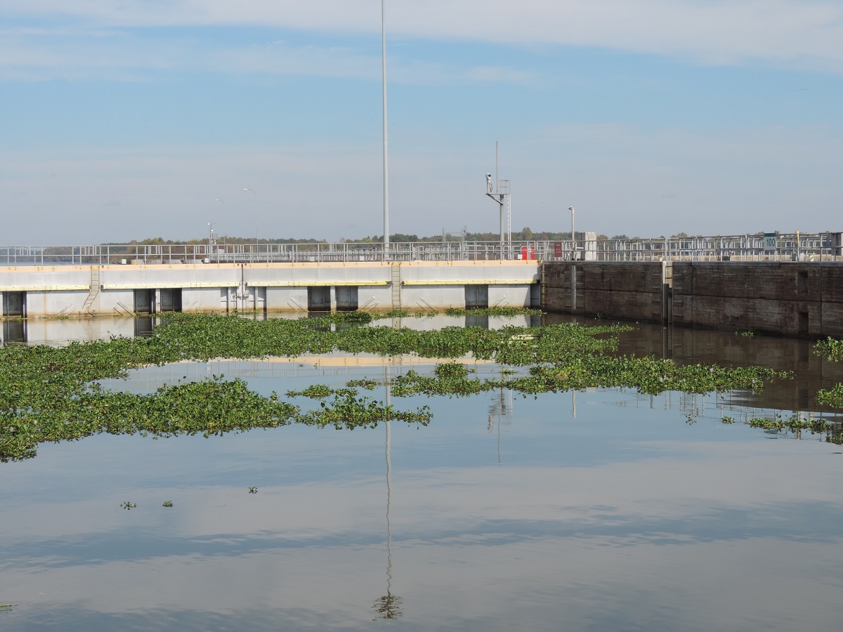
We had one very interesting lock as we were heading down. As we approached the lock it looked like we had to go through land to get there! As we got closer it turned out the whole area was covered with floating lilies....a bit unnerving to say the least.
With all the locks we've covered so far Jill is getting very good and comfortable in getting the boat secured. Only 2 more to to before the gulf!!
The next day we had planned to anchor again just below our last lock however there was a dredging operation going on blocking where we wanted to go. Oh well, we looked at the charts and the time and did some siferin' and figured we had time to make the marina at Demopolis, AL before dark. The plan worked out and we were tied up by 6:00. That was a long 90 mile day but still enjoyable.
Along the way we passed 2 cool features. First is the I-20/59 bridge. As many times as we have driven over that bridge on the way to NOLA I have always smiled and said...one day....
The other neat thing was passing the "white cliffs of Epes". I understand these are the same formations as those in Dover, England only smaller....who knows, ask Google. We were passed by a go fast boat just as we got there, ended up at the same marina with more fuel in my tanks.
We also began to see Spanish Moss in the trees about this time. We're getting south now!!

Two big things about getting here; we have officially passed the half way point on the Tenn-Tom, and this is the last marina we will see till Mobile Bay! Actually just above this marina the Tennessee Tombigbee waterway ended where the Black Warrior river joins the waterway. From here to the top of Mobile Bay we will be on the Black Warrior-Tombigbee waterway.
Had some good storms last night and rain all day today so we may get a bit of push as we head down river. Hopefully there won't be too much drift in the water. This will be the last post till Mobile for sure. No marinas or reliable cell service between here and there. Basically we will travel till an hour or two before sunset (5 o'clock now) and find a spot out of the channel to anchor. We have looked at the charts and figure it will take about 4 days to Fairhope on the Eastern shore of Mobile Bay. Wish us luck!!
 |
| View on the chart-plotter. |
 |
| Our view for the next 25 miles. |

Bay Springs Marina was not much more than a convenient place to stop for the night. No restaurant or amenities and a bit pricey for what you get. We were underway early the next morning to start heading through the locks. Whitten Lock was just below the marina and the largest drop of the entire waterway at 84 feet. After this the locks would drop 25-30 feet and only take about 20 minutes each to get through. The lock-masters pass along who is passing through and the next lock is ready when you get there.
 |
| Our 2 buddy boats in Whitten Lock. |

After the first three locks our new friends on Jammin Jane and Knot Sew Easy pulled into Midway Marina but Jill and I decided to press on and finish the next three locks. We pulled into an old section of the river channel and spent a nice quite night at anchor. We look forward to meeting up with them again when we hit the gulf.

The next couple of days we were pretty much by ourselves as we traveled along. We stopped at Pirates Cove Marina the next night and had a bit of time to tour the Tom Bevill visitors center and the old snag boat Montgomery. Very interesting and a nice chance to stretch our legs after 2 days on the boat.
 |
| Visitors Center at Bevill Lock. |
 |
| Snag Boat Montgomery. |
 |
| Zoom In... |
 |
| After the doors closed behind us. |
 |
| Happy Crew!! |
Along the way we passed 2 cool features. First is the I-20/59 bridge. As many times as we have driven over that bridge on the way to NOLA I have always smiled and said...one day....
 |
| Today's the day! |
 |
| The white cliffs of Epes. |

Two big things about getting here; we have officially passed the half way point on the Tenn-Tom, and this is the last marina we will see till Mobile Bay! Actually just above this marina the Tennessee Tombigbee waterway ended where the Black Warrior river joins the waterway. From here to the top of Mobile Bay we will be on the Black Warrior-Tombigbee waterway.
Had some good storms last night and rain all day today so we may get a bit of push as we head down river. Hopefully there won't be too much drift in the water. This will be the last post till Mobile for sure. No marinas or reliable cell service between here and there. Basically we will travel till an hour or two before sunset (5 o'clock now) and find a spot out of the channel to anchor. We have looked at the charts and figure it will take about 4 days to Fairhope on the Eastern shore of Mobile Bay. Wish us luck!!
Subscribe to:
Posts (Atom)